
An MDVR that records camera footage but does not record GPS data gives you a video of what happened but not where, when, or how fast. In an insurance claim, that distinction matters. A forward-facing camera captures a collision. The footage shows the impact. What it does not show — without GPS — is that the vehicle was travelling at 38mph in a 40mph zone, that the incident occurred at the junction of the A47 and the B1332 at 06:43:12, and that the vehicle had not deviated from its scheduled route. With GPS synchronized to the video, all of that is on record.
GPS in an MDVR is not simply a location tracker added alongside camera recording. It is integrated with the video stream so that every frame of footage carries a timestamp, a precise location, and a speed reading. The result is a complete incident record that tells the legal and insurance story, not just the visual one.
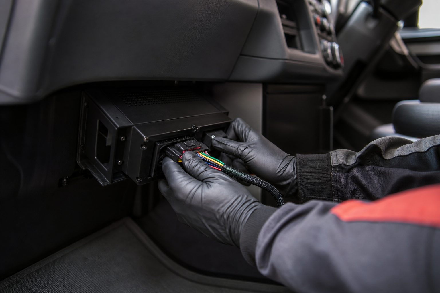
The MDVR receives GPS data from a GPS module — either built into the unit or connected via an external antenna routed to provide good satellite visibility. The GPS module calculates the vehicle’s position (latitude and longitude), speed, heading, and altitude at regular intervals — typically once per second.
This data stream is combined with the video stream inside the MDVR. Every recorded frame is tagged with the GPS reading at that moment. The tagging is automatic and continuous: there is no configuration required to ensure GPS data appears in footage, and no action the driver needs to take. When the MDVR is powered and satellites are acquired, every frame of recording carries its position and speed data.
On the fleet management platform, the GPS data appears in two forms: as an overlay on the footage (showing speed and location at each moment of video playback), and as a separate data log that can be queried independently of the video. The data log is the basis for route replay and historical journey analysis.
When a transport manager reviews footage from a connected MDVR platform, the playback interface typically shows:
Speed at each moment: A live speed reading overlaid on the video, updated as the footage plays. A question that arises in every serious incident — “how fast was the vehicle travelling?” — is answered directly from the footage without any calculation or estimation. The reading is GPS-derived and timestamped to the second.
Position on map: The vehicle’s position displayed on a map panel alongside the video. The map updates as the footage plays, showing exactly where the vehicle was at each point in the recording. For incident reconstruction — “where was the vehicle when the brake marks started?” — the GPS-video synchronisation gives the precise location.
Route on map: The full route of the journey, plotted on a map with timestamps. This shows the vehicle’s path before, during, and after any incident. For a claim that disputes whether the vehicle was in the correct lane, on the correct road, or within a permitted zone, route data provides direct evidence.
Heading and direction: The direction the vehicle was travelling, which combined with speed and position gives investigators a complete picture of vehicle dynamics at the time of an incident.
A question that fleet managers raise when reviewing their MDVR platform is how useful GPS data actually is in a claim dispute. The answer, in practice, is significant — particularly for the incidents where the visual footage alone leaves questions open.
Speed disputes are the most common scenario. A third-party claim alleges that the fleet vehicle was travelling too fast. The video shows the incident. The GPS speed log shows the vehicle was at 31mph at the moment of impact, in a 30mph zone. That data is contemporaneous, recorded by the vehicle’s own systems, and timestamped to the second. It is not a reconstruction from dashcam timestamps or a calculation from satellite imagery. It is a direct record from the incident moment.
Route compliance disputes arise when a third party alleges the fleet vehicle was in an unexpected location or on an unsanctioned route. The GPS route log shows exactly where the vehicle was at every point in the day. If the vehicle was on its scheduled route, the log proves it. If the vehicle deviated — an issue that may arise in driver behaviour review as much as in incident claims — the log shows that too.
Geofence evidence is relevant for operations where vehicles are restricted to defined service areas. If a claim arises from an incident outside the vehicle’s designated operating zone, the GPS data shows whether the vehicle was within that zone or not.
Fleet managers sometimes ask how MDVR GPS compares to standalone GPS trackers — separate devices installed for location and route tracking independent of camera systems. The answer depends on what the tracking data is being used for.
Standalone GPS trackers provide location, speed, and route data but no video. They are widely used for basic fleet tracking, route compliance monitoring, and driver performance scoring. The data is accurate and useful for these purposes.
MDVR GPS adds the video layer: the same location and speed data, but synchronised to footage from all camera positions. The combination produces incident evidence that standalone tracking cannot provide — you can see what the GPS data describes. For incident defence and insurance claims, the video-GPS combination is substantially more useful than either data source alone.
For fleets that already have standalone GPS tracking, an MDVR does not replace it — the MDVR GPS record is specific to the MDVR recording period and integrates with the MDVR platform. If your fleet uses a separate telematics platform for route and performance management, the MDVR GPS is supplementary rather than a replacement, focused on the evidence use case.
A practical question that comes up when setting up MDVR systems in vehicles with limited external antenna options is what happens if GPS signal is not available — in tunnels, underground loading bays, or dense urban canyons.
During GPS signal loss, the MDVR continues recording video. The GPS overlay on the footage shows the last known position and speed until signal is reacquired. The GPS log records the interruption. On most MDVR platforms, brief GPS outages are noted in the data but do not affect the integrity of the surrounding record. For an incident during a GPS outage, the video evidence is still present; the position and speed data is interrupted.
For the majority of incident scenarios — on public roads, in open environments — GPS signal is continuous and uninterrupted. The cases where GPS signal is genuinely absent are typically in loading bays and depots, where vehicle speeds are low and the incident risk profile is different from road incidents.
Most commercial MDVR systems include GPS as standard or offer it as a module. It is worth confirming GPS inclusion when specifying — some lower-cost units offer GPS as an optional add-on rather than built-in. For fleet evidence purposes, GPS should be considered a mandatory component, not an optional extra.
GPS-derived speed readings in commercial MDVR systems are typically accurate to within 1–2mph. The reading is an instantaneous GPS calculation rather than derived from the vehicle’s speedometer. For legal proceedings, GPS speed evidence has been accepted in UK courts; the accuracy level is sufficient for the primary use cases of speed verification in incident reconstruction.
GPS data from vehicle tracking and MDVR systems has been used in UK legal proceedings. The data is contemporaneous, recorded automatically, and not dependent on human interpretation at the time of recording. Its admissibility depends on proper chain of custody and whether the recording system was functioning correctly. Courts have accepted GPS-video evidence in road traffic cases and insurance disputes.
Route replay allows the fleet manager to view the vehicle’s complete journey plotted on a map, with the ability to step through the route and play back the corresponding footage at any point. It is used for incident investigation, route compliance review, and driver performance analysis. Most connected MDVR platforms provide route replay as standard functionality.
GPS data shows speed, acceleration, braking patterns (via speed change rate), and route. Driver-facing cameras with behaviour detection (DMS) provide separate evidence of in-cab behaviour. The combination of GPS data and camera footage gives fleet managers both the objective vehicle dynamics record and the visual evidence needed for driver coaching conversations.
A one-page checklist for verifying MDVR GPS is correctly configured for incident evidence — installation, platform data, evidence quality, and driver behaviour review.
Tell us what vehicles you run and what you need — we will come back with a recommendation and a price. Prefer to talk? Call 01656 721871.
Related guides: 4G vs 5G MDVR Units: Which Is Best for Fleets? · Downloading Evidence Footage for an Insurance Claim
4 August 2026
Monday to Friday:
8.30am-5.30pm